
Voyage planning is one of the most important ship operations, and all vessels transporting cargo from one port to another must have a voyage plan before sailing.
On the surface, you might see this simply as drawing lines on charts or ECIDS (Electronic Chart Display and Information System) and marking obvious dangers near the routes.
However, it goes beyond the surface, encompassing extensive guidelines and best practices that serve as the very backbone of safe, efficient, and successful voyages.
That’s why you can see your Second Officers constantly communicating with the Captain and performing overtime jobs on the bridge just to prepare the passage plan as soon as he receives the orders.
What is voyage planning?
Voyage Planning, also known as Passage Planning, is a process of developing a detailed strategy for a ship’s journey from one port to another. For this article, I’ll be using both terms to mean the same thing.
The goal of passage planning is for vessels to have safe and efficient navigation using the shortest and most convenient route.
That said, the right voyage plan can be very comprehensive and would take the Second Officer days to complete, especially if the voyage is long and involves multiple passages and ports of call.
Factors to consider when planning your voyage
Voyage planning can be meticulous, and numerous factors must be considered to ensure a successful passage at every stage.
Here are some factors to consider when planning your voyage:
- Vessel Specifications – The ship’s type, speed, size, and other particulars.
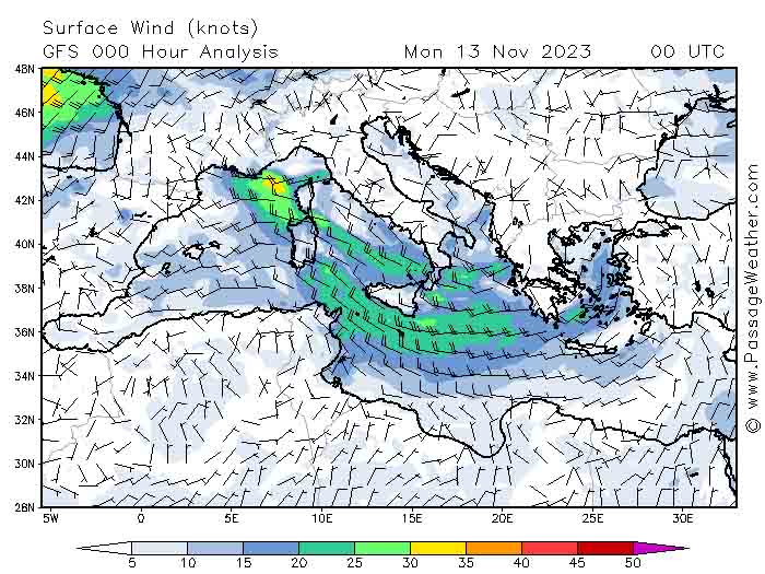
- Weather Conditions – Considering the possible meteorological conditions along the planned route.
- Ocean Currents – These significantly affect the ship’s course and speed.
- Tides – Changes in the tide affect the water depth in ports and harbors.
- Navigational Hazards – Identify and avoid rocks, reefs, and other hazards.
- Route Optimization – The shortest, safest, and most convenient route will save you time and bunker costs.
- Waypoint Determination – Defining specific waypoints facilitates effective navigation.
- Regulatory Compliance – Voyage plans must comply with all applicable regulations, such as draft restrictions, including air drafts, load line requirements, and reporting requirements.
- Port Information – The location of the port, pilot station, restrictions, and even regulations affecting shipping are also of utmost importance.
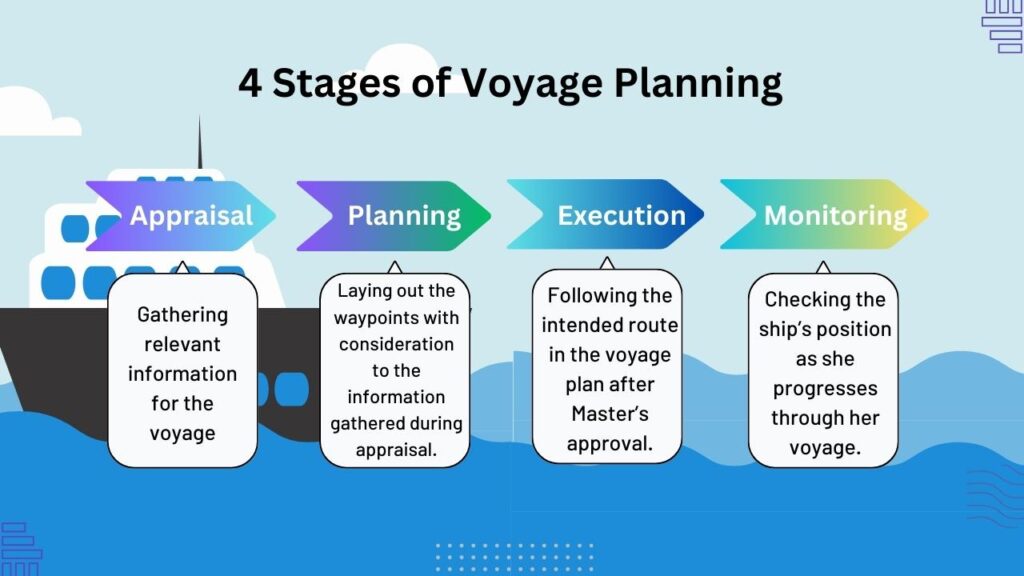
4 Stages of Voyage Planning
Information regarding the regulations that cover passage planning can be found in SOLAS Chapter V (Safety of Navigation), Regulation 34, STCW Code Section A – VIII/2 Part 2, and IMO Resolution A.893(21) – Guidelines for Voyage Planning.
Among the three, only the latter details the four key stages of voyage planning. Abbreviated as APEM, here they are and their importance.
1. Appraisal
This stage involves gathering and assessing all relevant information about the intended voyage. This is also where we identify the factors to consider when passage planning, as listed above.
Understanding those factors sets the foundation for informed decision-making throughout the voyage.
2. Planning
During this stage, the navigating officer develops a comprehensive strategy for the voyage. This includes charting the course, determining waypoints, and considering various navigational aspects.
This is where you apply all those factors to your voyage plan to create the safest and most optimized passage plan.
At this stage, the Master reviews the plan and offers amendments or revisions until satisfied.
3. Execution
The execution stage involves putting the passage plan into action.
It requires effective coordination among the ship’s officers, adherence to the planned route, and continuous monitoring of weather conditions and vessel performance.
Proper execution ensures that the voyage progresses smoothly and safely.
4. Monitoring
A well-crafted voyage plan is not set in stone, as it remains adaptable to changes.
Continuous monitoring is crucial for identifying deviations from the planned route, assessing changing weather conditions, and responding to unforeseen challenges.
Real-time monitoring allows for prompt adjustments, contributing to the overall safety and success of the voyage.
Easy guidelines for preparing a passage plan
Creating your voyage plan can be overwhelming, given the amount of information necessary for the trip.
However, there are some urgent details that need to be taken care of even before you draw that first waypoint.
Let’s take a look at them here.
1. Locate the exact port location – Some ports may have the same name but are located in different countries. Check the voyage instructions and find the exact GPS location of the port.
2. Find the pilot station – After you have the port location, find the pilot station, as you will need it in the next step.
3. Get the Distance – The Master and Chief Engineer may immediately ask for the distance for the bunker and ETA calculations.
4. Get your departure draft – You should be able to get it from the Chief Officer.
5. Create your waypoints – This should be quick with your electronic chart using the small scale charts.
6. Request for the available charts and permits – Your small scale only serves as an overview to get the necessary charts of your routes. However, they lack the necessary details.
7. Load the charts and their updates – Load the charts and their updates and review your initial plan.
8. Create the route planning – Now that you have the large scale charts available with more details, create your route planning based on your initial route.
9. Create the markings – Mark the pilot stations, reporting areas, ECA limits, fuel switchover positions, parallel indexing, and other details specified in your company SMS.
10. Fill up the Voyage Planning Form – This is the printout copy of your passage plan or voyage plan containing the waypoints, reporting areas, the ship’s draft, and all details necessary for the voyage.

Voyage Planning Form
The voyage routing in ECDIS contains the visual representation of your passage, including the details listed above.
To turn that into black and white, all of that information must be transferred to the Voyage Planning Form.
Some companies may have this form in two or four pages. Others have them at 20, depending on the company policy. This is because all the details of your route are printed here for everyone to review and double-check.
Below is an example of a Voyage Planning Form filled with details necessary for the passage plan.
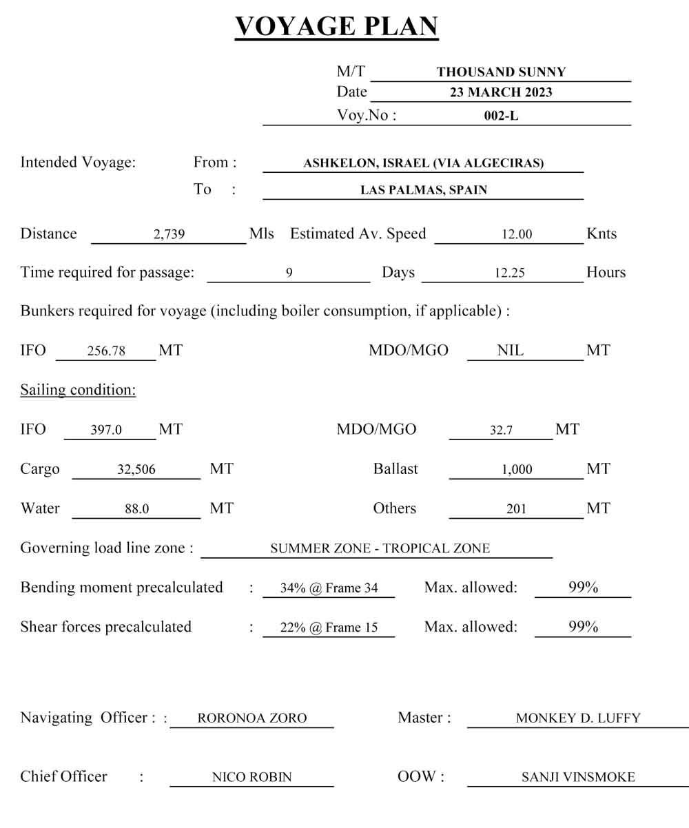
Voyage Plan from Ashkelon to Las Palmas page 1 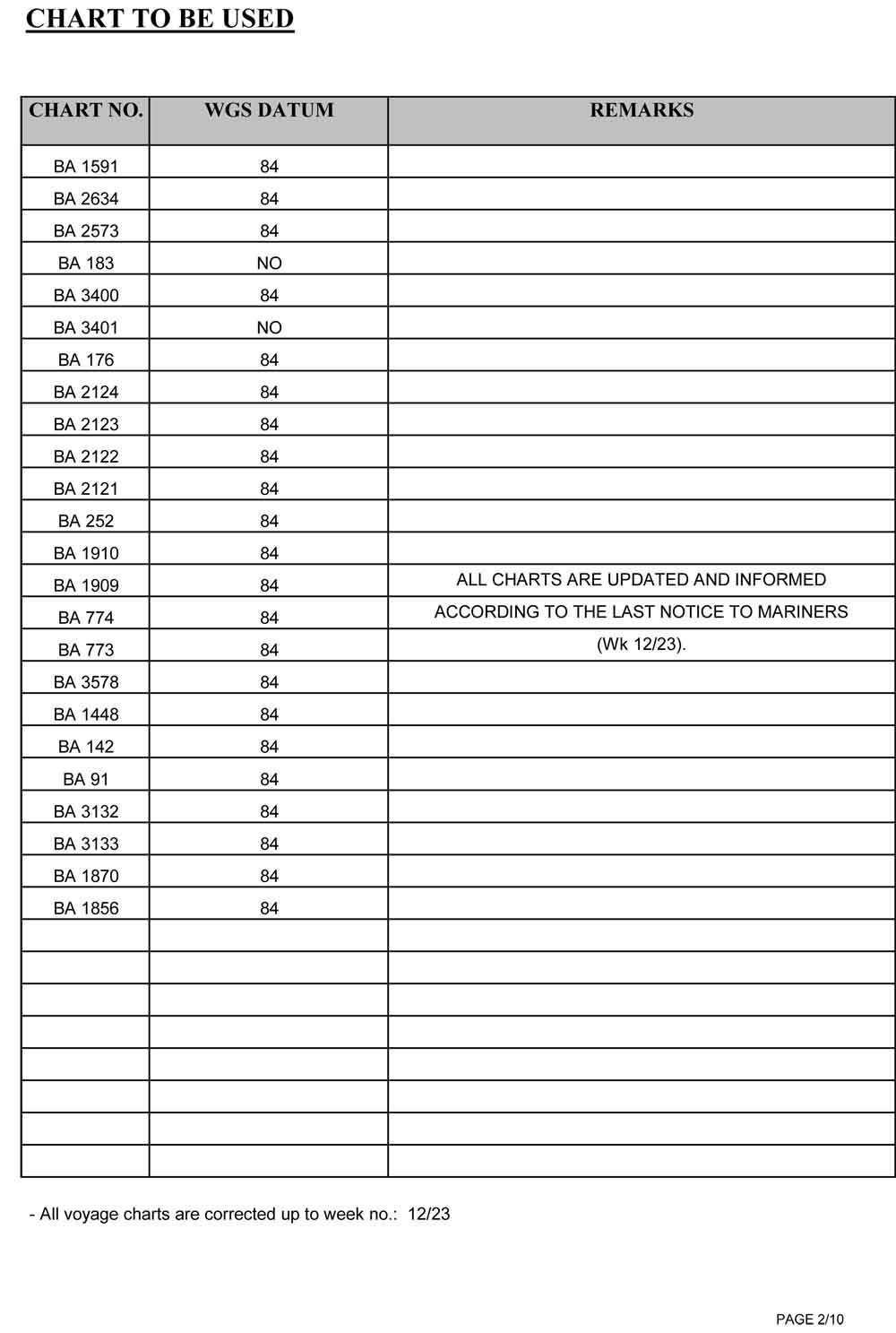
Voyage Plan from Ashkelon to Las Palmas page 2 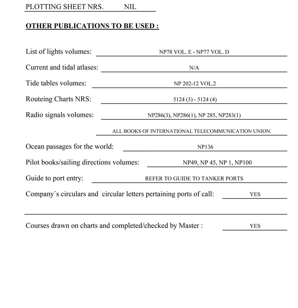
Voyage Plan from Ashkelon to Las Palmas page 3 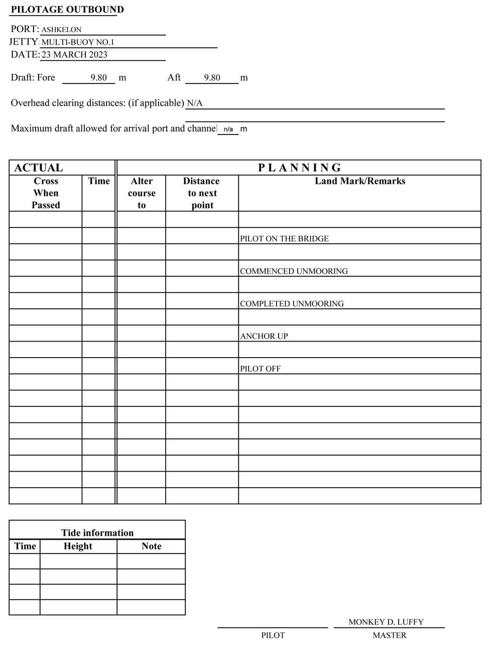
Voyage Plan from Ashkelon to Las Palmas page 4 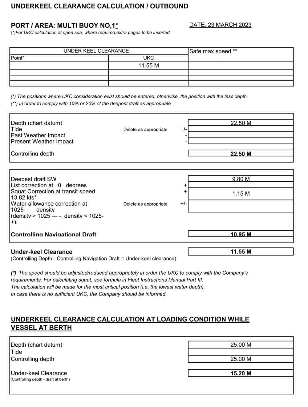
Voyage Plan from Ashkelon to Las Palmas page 5 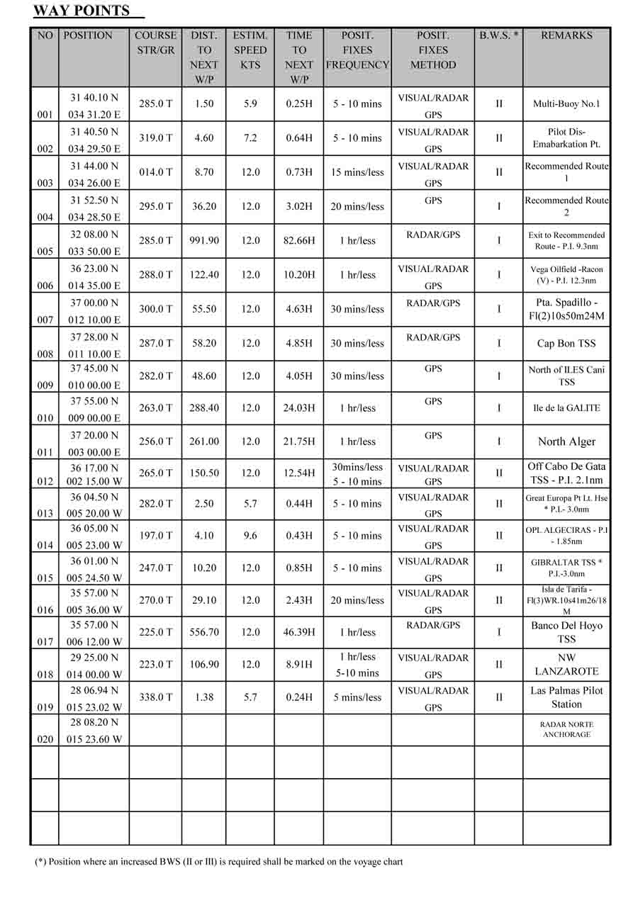
Voyage Plan from Ashkelon to Las Palmas page 6 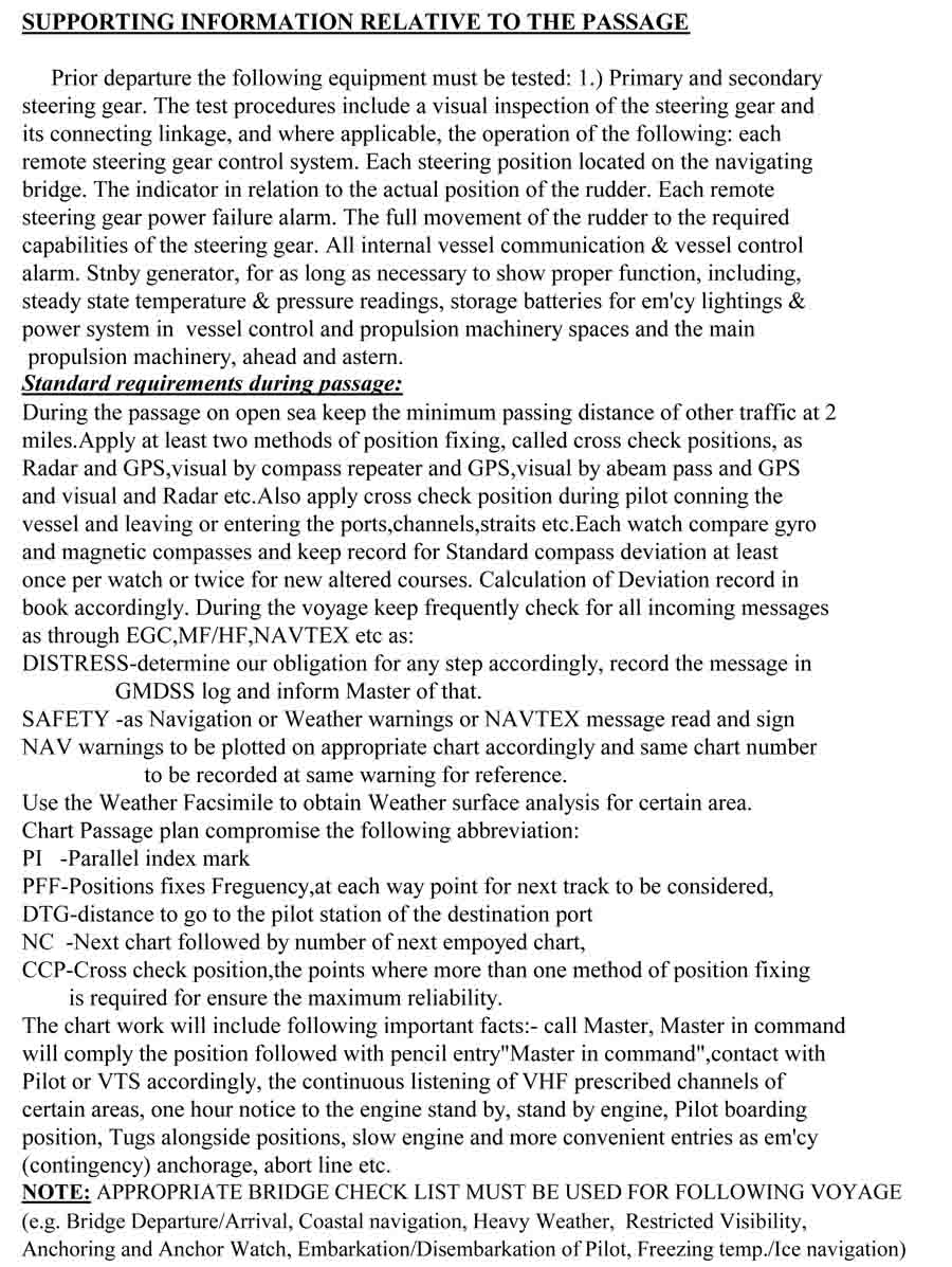
Voyage Plan from Ashkelon to Las Palmas page 7 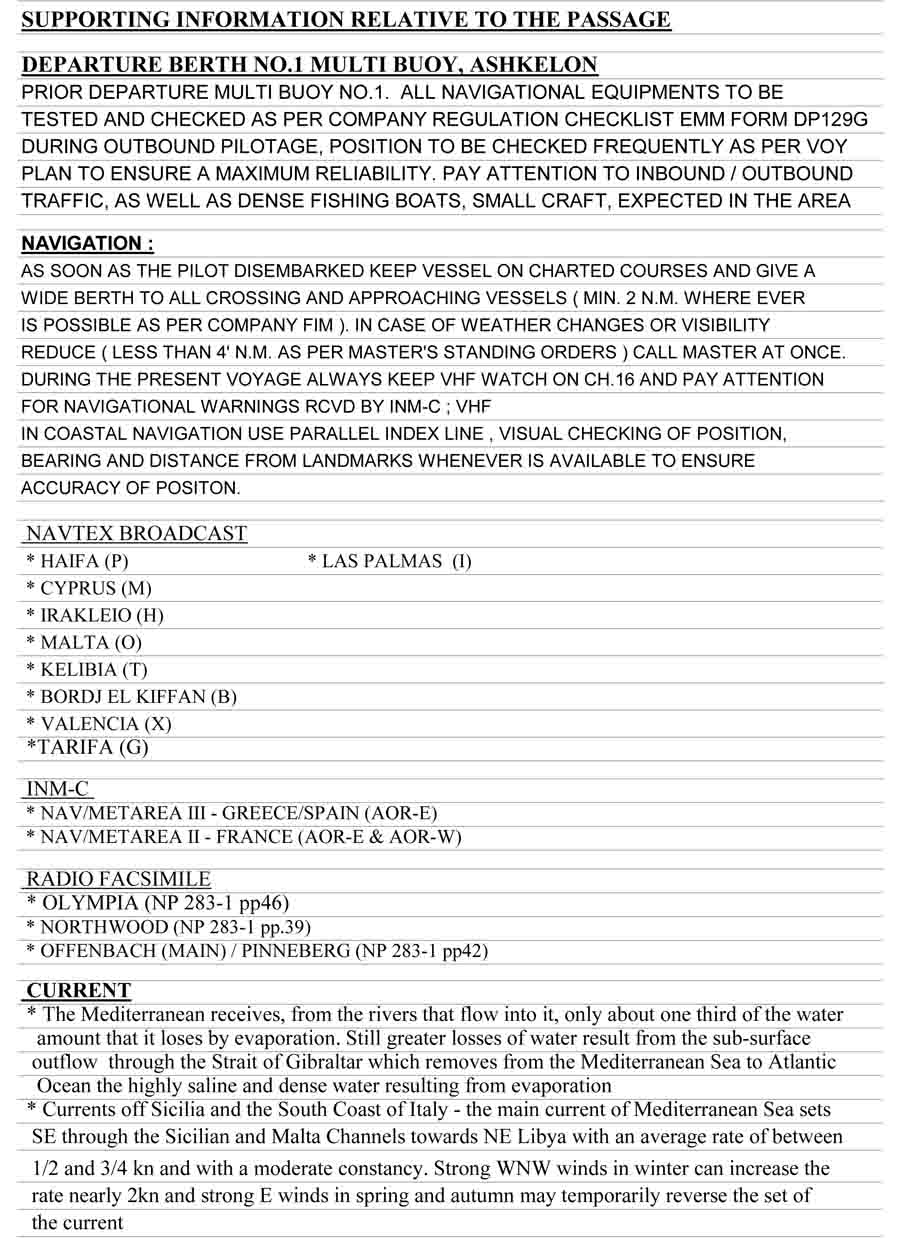
Voyage Plan from Ashkelon to Las Palmas page 8 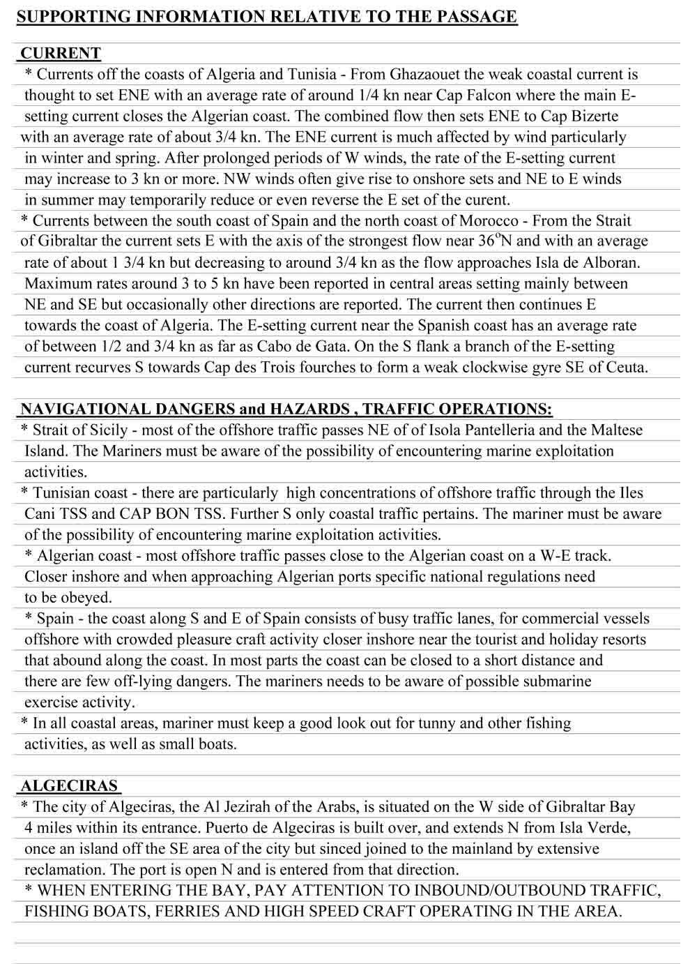
Voyage Plan from Ashkelon to Las Palmas page 9 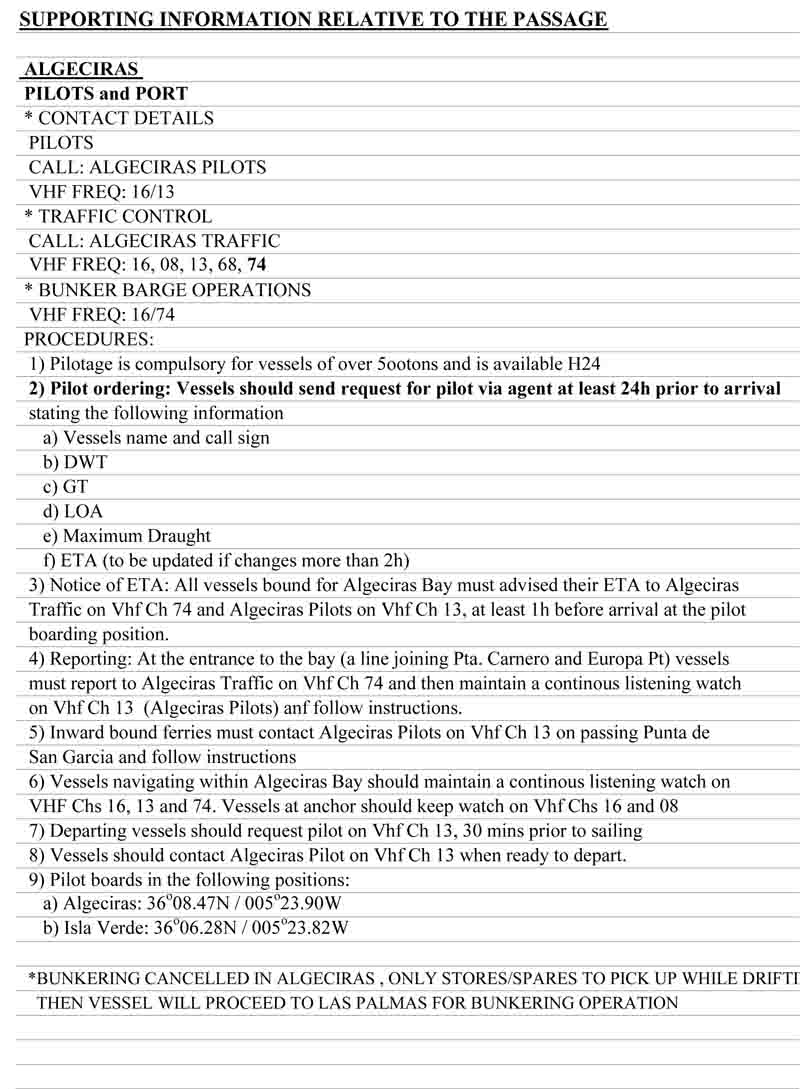
Voyage Plan from Ashkelon to Las Palmas page 10 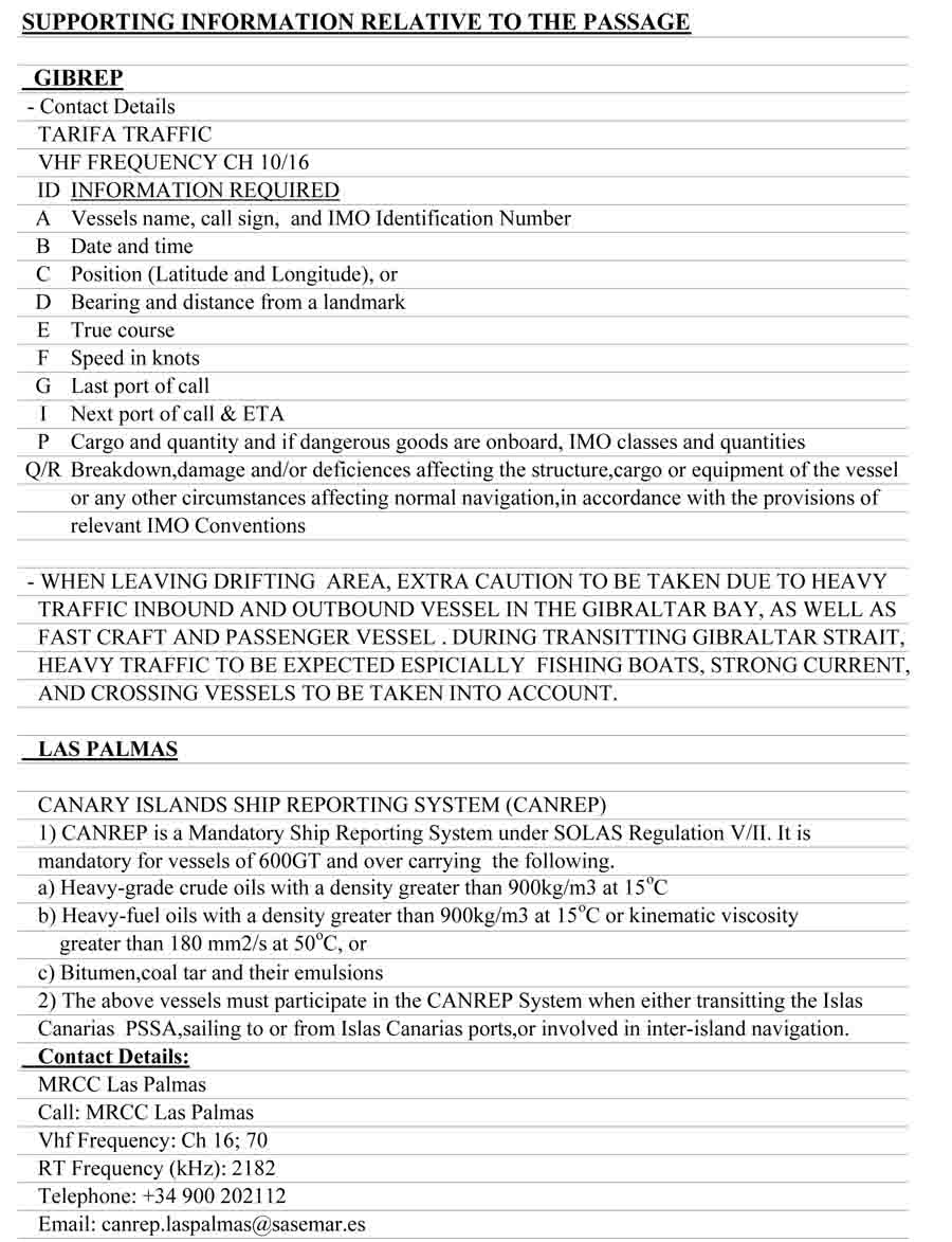
Voyage Plan from Ashkelon to Las Palmas page 11 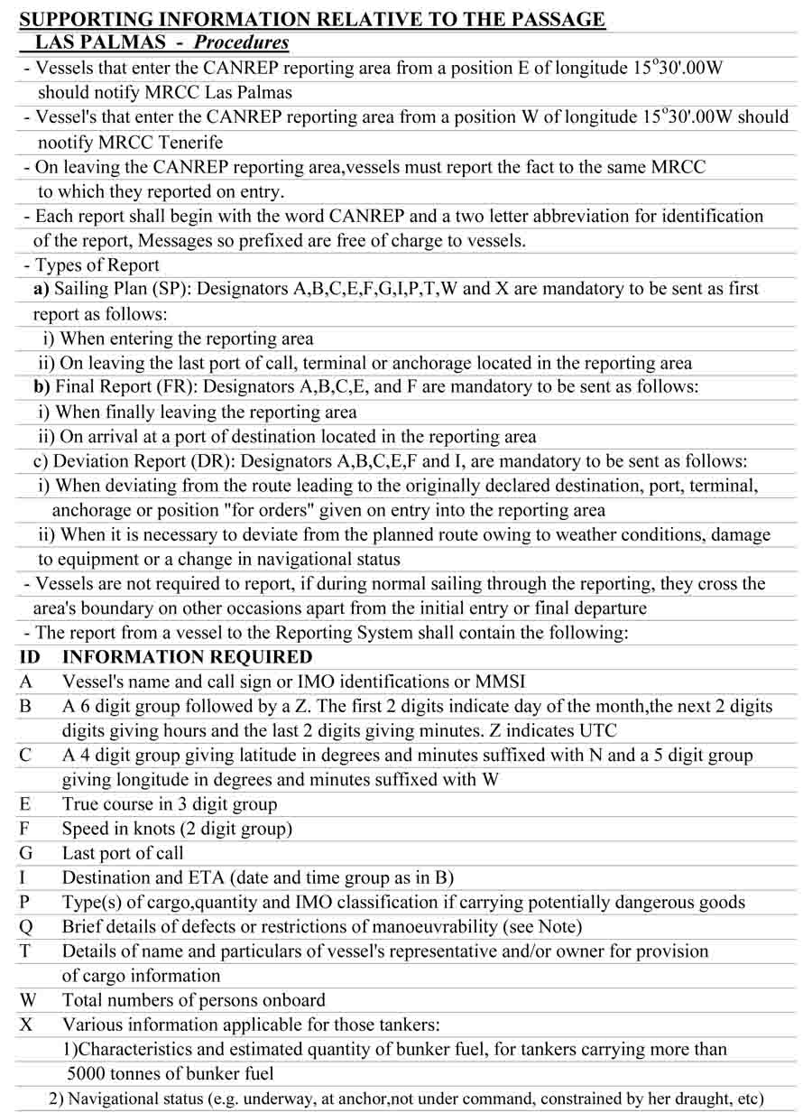
Voyage Plan from Ashkelon to Las Palmas page 12 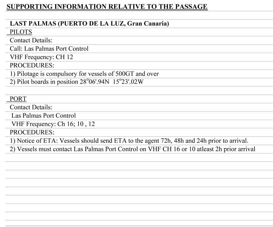
Voyage Plan from Ashkelon to Las Palmas page 13 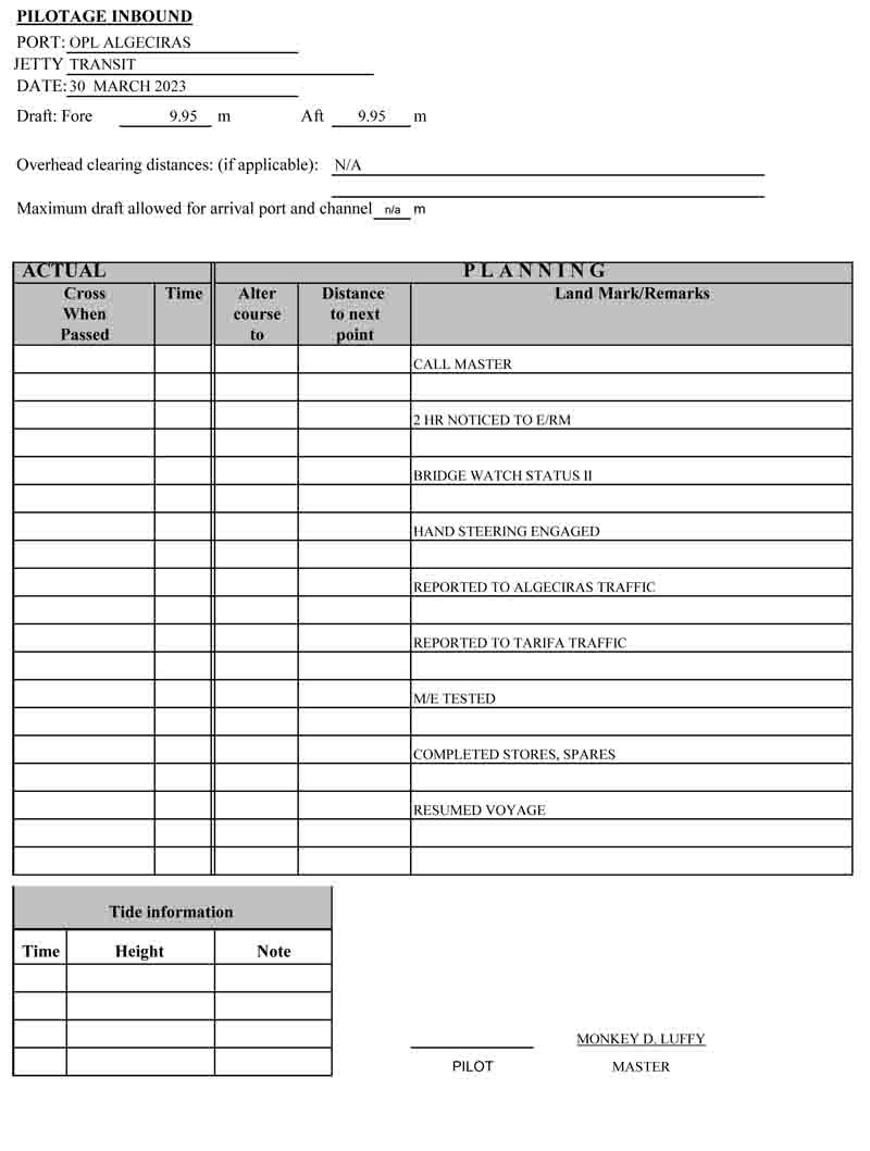
Voyage Plan from Ashkelon to Las Palmas page 14 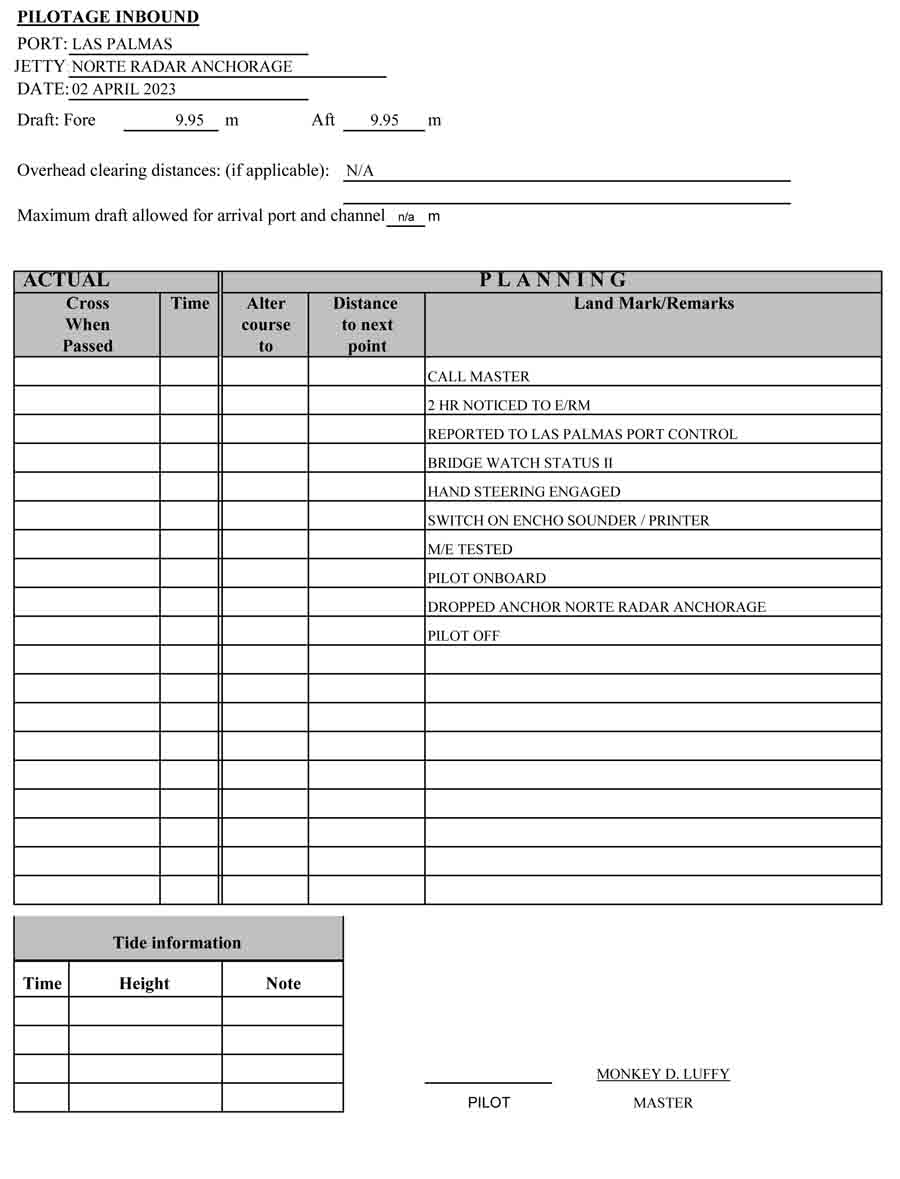
Voyage Plan from Ashkelon to Las Palmas page 15 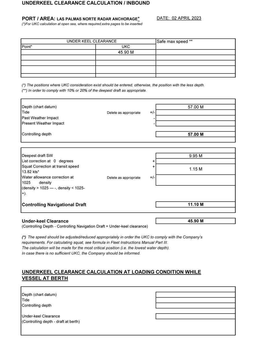
Voyage Plan from Ashkelon to Las Palmas page 16 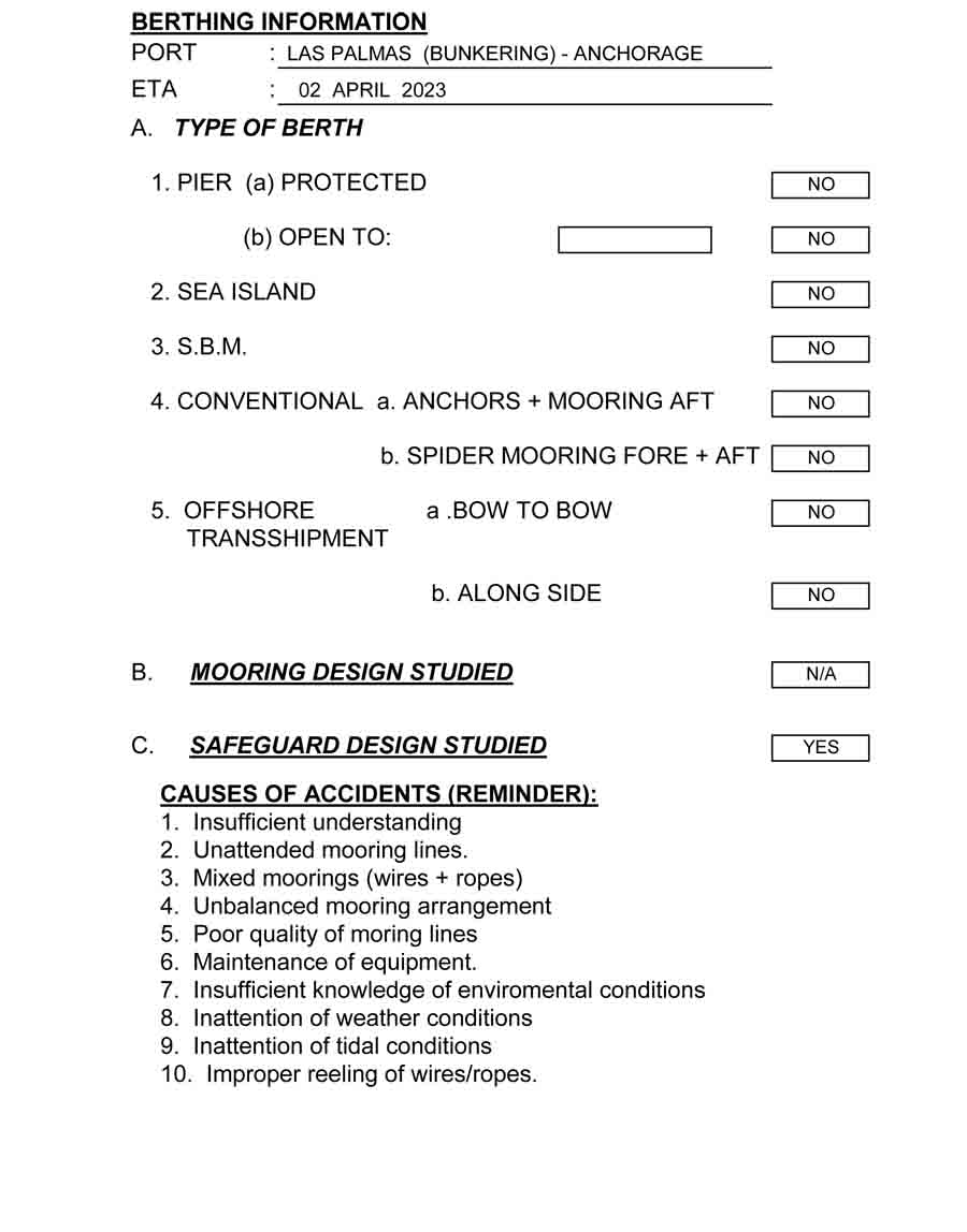
Voyage Plan from Ashkelon to Las Palmas page 17
May the winds be in your favor.
A family man, he loves writing, reading, investing, and watching the golden hours while sailing.

Thanks for this blog. Superb
You’re welcome! Glad you like it.
Love The blog , Will give it a like and follow 🙂
From an old seafarer to a modern seafarer: Very interesting and perhaps a little easier now you have GPS and computers. Well done!
Ships are known to usually being left behind when it comes to technological advancements. I still remember ten years ago how our second officers work so hard with the voyage plan and chart corrections especially if vetting inspection is at next port. But today, everything is done with a click of the mouse. Technology really made a huge impact on the life and work on board.